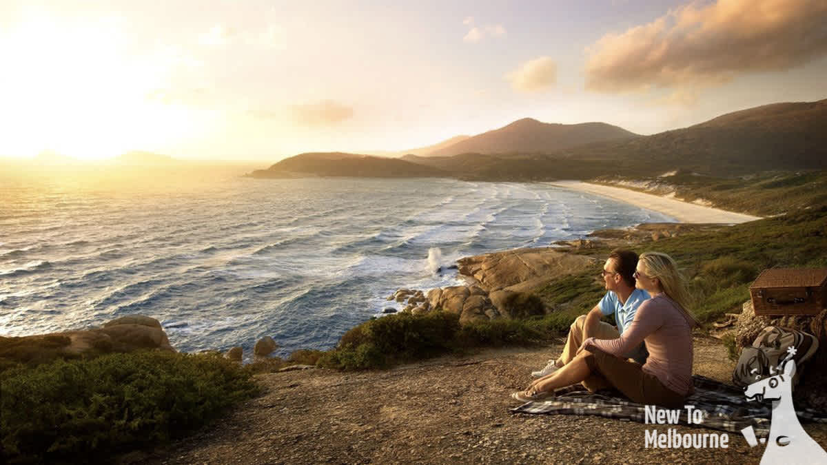
Wilsons Promontory

Intro:
Wilsons Promontory has been known as a "secret" for a long time. This is because trips like the Great Ocean Road and it's iconic 12 Apostles lime stone stacks receive much of the attention and marketing from groups like tour companies and the governent. What's suprising, however, is how that many people acctually prefer a trip to Wilsons Promontory over the Great Ocean Road, for it's stunning hikes, beautiful sunsets and it's beautiful and photographic beaches.
So let's look at why you may want to visit:
[Highlight #1]: Mountain views over the ocean:
It's a unique combination of beaches, mountains and hiking trails that people lvoe about Wilsons. It's also not as common to have beaches and mountain hikes accessible in the same day (Grampians foro instances does have any beaches as it's inland).
The Mountains are perfect for casual hikers (they're small), so I often hike a mountain and hit the beach in the same day with when I take tour groups - you could easily do the same.
[Highlight #2]: White sands and clear waters:
The beaches and the giant stone boulders sprinkled along them are a real highlight of Wilsons Prom. The sand also squeaks under your feet when you walk - the fine, rounded grains of quartz sand compress under your feet, giving a high-pitched squeak.
For many people, this is quite novel and suprising to discover.
Squeaky Beach (water and rocky shore)
Location: Google Maps[Highlight #3]: Giant rock boulders and formations:
The rock formations at Wilsons are large and impressive. Many of the beach at Wilsons Promontory feature their own unique set of rock boulders that often make for great photo subjects or unique backdrops.
[Highlight #4]: River foot bridge:
Tidal river is the main river that passes along side the camp grounds (The camp grounds was named "Tidal River Camp Grounds" after it). This bridge is part of a popular hike but also a popular spot for kids that want to jump off into the water or paddle around (ussually during summer). The bridge is 5 minutes walk from the camp grounds.
Tidal River Foot Bridge
Location: Google Maps[Highlight #5]: Nature filled mountain trails / hikes:
The highlight of the mountains are ussually the summits. However the hikes / walks up to the summit are nature filled and a great experience themselves. Just be prepared for rocks and tree roots sticking out of the ground and ready to trip you up on some hikes (thongs / flip-flops aren't recommended).
Mount Bishop Walking Track
Location: Google Maps[Highlight #6]: Wildlife:
We often see wombats in Wilsons promontory. Kookaburras and Rosellas (both birds) are very common too (particularly around the campgrounds).

Wombat at Wilsons promontory
Whale watching:
From May to October, humpback whales migrate along the Victorian coastline from Antarctic waters. There's whale watching cruises that offer sightseeing whale watching tours.
Logistics / planning:
During peak season (e.g. summer) and on public holidays the camp grounds are often completely booked out - often weeks in advance.
Campgrounds:
If you want to stay overnight, look to book (or check availability for your preferred date) as early as you can. You can check it here:
https://bookings.parks.vic.gov.au/tidal-river-campground
History:
Wilsons Promontory was named after Thomas Wilson, an English merchant. It was visited in 1798 by the English explorer George Bass and was first called Furneaux Land.
It's the most southen point of mainland Australia. The peninsula was first occupied by the Koori people at least 6,500 years prior to the arrival of European settlers.
Map:
How to get here:

Wilsons Promontory - 1 day bus tour (super cheap!)
1 day group trip to Wilsons promontory; a must visit destination that has a unique combination of mountains and stunning white sand beaches.Duration: 12 hours
A good option when visiting Wilsons Promontory is to go via campervan:
What are the advantages of campervanning?


